Scientists Study Intraseasonal Variation of Eastern Tibet Plateau Summer Rainfall to Improve 2-3 Week Forecasts
Date:2017-03-02
Demands are growing rapidly in the operational prediction and applications communities for forecasts that fill the gap between weather and climate: intra-seasonal scale.
“The lack of observational and mechanism studies on mid-latitude intra-seasonal variation (ISV) impedes extended-range forecast improvement in East Asia.“ said Dr. YANG Jing, the first author of a recent study published in Climate Dynamics. YANG, an associate professor at Beijing Normal University (BNU), has been working on ISV for 10 years after she received her PhD in Institute of Atmospheric Physics(IAP), Chinese Academy of Sciences.
“On the intra-seasonal time scale, the anomalies of the vortex over the Tibetan Plateau (TP) can strongly affect the initiation and development of drought and flooding conditions in the Asian monsoon region during the boreal summer. Therefore, recognizing the ISV over the TP is crucial for improving extended range forecast of both local and downstream regions.” She said.

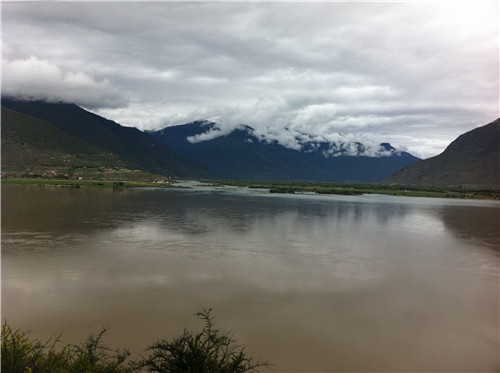
Photo of rainfall taken near an observation station in Nyingchi County, Tibet Autonomous Region on 26 July 2011 (Image by YANG Jing)
In this study, YANG and her IAP collaborators detected two dominant peaks of ISV, centered on quasi-biweekly (12–24) days (QBW) and quasi-9 (8–11) days using 20-year daily rainfall data over the Eastern TP. They found that for the QBW, its mid-latitude wave train featured an upper-level southeastward migration, originating in Northern Europe and traveling via the East European Plain, the Ural Mountains, Lake Balkhash–Lake Baikal, the Mongolian Plateau, and then continued southward to the ETP and South Asia. Its tropical wave train was characterized with a northwestward/northward migration in low-level, starting from the Philippine Sea (PS)–South China Sea (SCS) region, moving over northern Bay of Bengal–SCS region, and arriving over the southern fridge of TP and southern China.
In contrast, for quasi-9-day, the most significant mid-latitudes variability featured an eastward propagating upper-level wave train, originating from Western Europe, passing across the Mediterranean, the Black and Caspian seas, arriving over the TP, and moving towards East Asia. And the most evident tropical variability exhibited a clear northwestward/westward migration of a low-level wave train, originating from PS, passing over Taiwan island, and subsequently moving towards southeastern China.
“Because the two ISV modes have different spatiotemporal features of associated wave trains, their distinct linkages with eastern China rainfall anomalies are also distinct." YANG explained, "The distinct evolution related with the two ISVs over the ETP described here may provide a very useful guidance for 2–3 weeks (extended range) forecasts over the ETP and its downstream regions.”
Reference:
Yang, J., Bao, Q., Wang, B. et al. Characterizing two types of transient intraseasonal oscillations in the Eastern Tibetan Plateau summer rainfall, Clim Dyn (2017) 48: 1749. doi:10.1007/s00382-016-3170-z https://link.springer.com/article/10.1007/s00382-016-3170-z
Contact: YANG Jing, yangjing@bnu.edu.cn
