China is frequented by Tropical cyclones (Fig.1) which brings gales, torrential rainfall and storm surges, resulting in severe disasters. The catastrophe caused by the TC (No.7503) in 1975 remains fresh in our memory. In recent years, hazards by TCs (especially landfalling ones) lead to an annual economic loss of about 40 billion RMB in China.
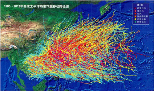
Fig.1 TC tracks during 1985-2012 (source: Science World)
Strong winds (gales) (Fig.2) of TCs are one of the main disastrous factors and one of the main forecasting objectives in operational predictions of TCs. Numerical Weather Prediction (NWP) models can provide forecasts of tracks, intensities, rainfall and winds of TCs. However, the predicted tracks and intensities by NWP models are often different from those by forecasters. Thus the predicted TC winds (TCwind in short) by NWP models could not be used by forecasters directly.
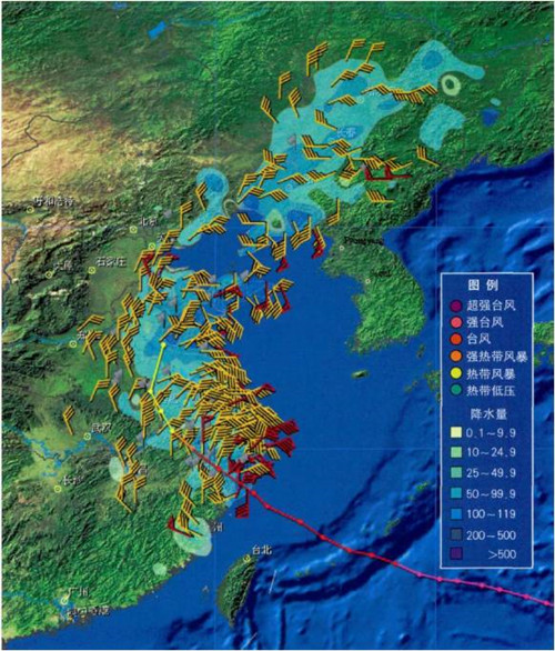
Fig.2 TC Winnie in 1997 (source: Science World)
Upon the request by China Meteorological Administration (CMA) and funded by Ministry of Science and Technology National Basic Research (973) program of China, researchers from Institute of Atmospheric Physics, CAS (CUI Xiaopeng, HUANG Yongjie and WANG Yaping) and their collaborators developed a dynamic correction forecasting technology for TCwind which solves the above problem. The technology had been tested for 2 years in China National Meteorological Center (NMC) before it was recently authorized to use in the forecast operations by CMA in March 2016. Based on the technology, a set of refined TCwind prediction products is obtained by using the forecaster-predicted TC tracks and intensities and NWP products from the GRAPES-TYM. The operational application of TCwind in CMA shows that the technology can markedly correct the TCwind prediction errors of the model (Figs.3 and 4). The refined tropical cyclone wind prediction products by TCwind are also provided to the public through the official website of NMC, CMA, China (Fig. 5).
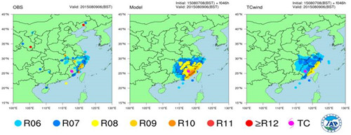
Fig.3 An example for TCwind application (Figure plotted by IAP)
Left panel for observation, central panel for GRAPES-TYM prediction,and right panel for TCwind prediction. R06-R12 stand for various wind scales.
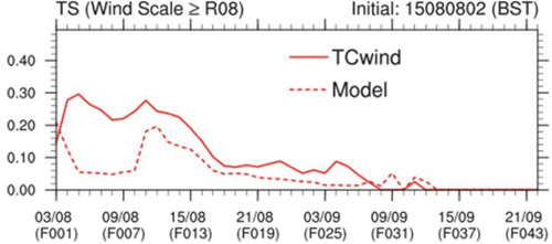
Fig.4 TSs of TCwind and model predictions (Figure plotted by IAP)
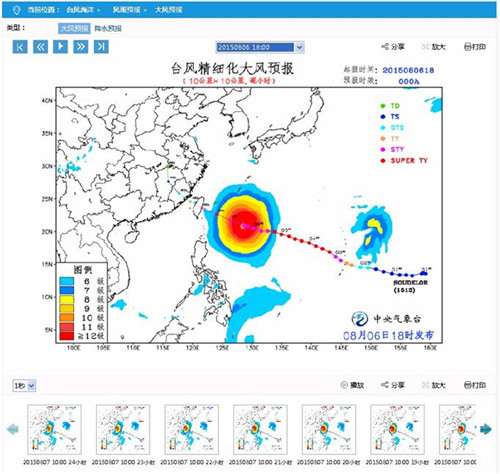
Fig.5 Snapshot of TCwind-based products on the official website of NMC, CMA (http://www.nmc.cn/publish/typhoon/wind.html)
