With disastrous effects and great uncertainty, heavy rainfall events in central north China have caused wide public concern over recent years. Previous studies have demonstrated that the formation of strong rainfall is closely connected with general circulations in middle and lower layers. Nevertheless, what role the upper tropospheric temperature plays in the circulation structure associated with heavy rainfall, and what the connections are between different circulation structures and heavy rainfall events leave to be further discussed.
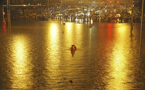
(A heavy rainfall in Beijing on 21 July 2012. The photo was taken at Guangqumen Bridge, Chongwen District. Rainfall amount: 190.3 mm averaged over Beijing. Photo from Sohu.com)
Concentrating on the above questions, scientists from Institute of Atmospheric Physics and China Meteorological Administration found that two major circulation structures characterized by upper tropospheric temperature anomalies exist before heavy rainfall in central north China. Their studies pointed out that the two circulation structures have different rainfall producing mechanisms: under hydrostatic and
geostrophic equilibriums,
the warm upper tropospheric anomaly motivates an anti-cyclonic (cyclonic) circulation in its upper (lower) layer, bringing upper divergence (lower moist convergence) to central north China; contributed by the cold upper tropospheric anomaly, a cold trough appears in the upper stream of north China, and a strong local unstable environmental configuration forms around central north China.
Moreover, results indicated that the warm and cold anomalous circulations might be the leading circulation structures that instigate the two typical types of rainfall in North China.
The warm anomalous circulation has a solid relationship with the large-scale, long-duration rainfall events with a diurnal peak around midnight to early morning; and the cold anomalous circulation is closely connected with local, short-duration rainfall events concentrated from late afternoon to early nighttime.
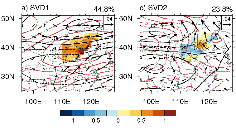
Fig. 1. Two leading SVD modes of the 300 hPa temperature anomaly and 700–850 hPa geopotential height anomaly on heavy rainfall days. The sienna contours denote the 300 hPa temperature, the black contours denote the 200 hPa regressive zonal wind, the vectors denote the 700–850 hPa regressive wind field, and the shading denotes the regressive rainfall.
Their findings have been published in Weather and Forecasting, and Journal of Geophysical Research: Atmospheres in 2015.
Reference:
Wei Sun, Rucong Yu, Jian Li, and Weihua Yuan, 2015: Three-Dimensional Circulation Structure of Summer Heavy Rainfall in Central North China. Wea. Forecasting, 30, 238–250.( http://dx.doi.org/10.1175/WAF-D-14-00046.1 )
Wei Sun, Jian Li, Rucong Yu, and Weihua Yuan, 2015: Two Major Circulation Structures Leading to Heavy Summer Rainfall over Central North China, J. Geophys. Res. Atmos. doi: 10.1002/2014JD022853
(http://onlinelibrary.wiley.com/doi/10.1002/2014JD022853/abstract?campaign=wolacceptedarticle)
Contact: SUN Wei, sunwei@lasg.iap.ac.cn